Bestand:Arctic Ocean location map.svg

Afmetingen van deze voorvertoning van het type PNG van dit SVG-bestand: 600 × 599 pixels Andere resoluties: 240 × 240 pixels | 481 × 480 pixels | 769 × 768 pixels | 1.025 × 1.024 pixels | 2.051 × 2.048 pixels | 709 × 708 pixels.
Oorspronkelijk bestand (SVG-bestand, nominaal 709 × 708 pixels, bestandsgrootte: 589 kB)
Dit is een bestand van Wikimedia Commons. Onderstaande beschrijving komt van de beschrijving van het bestand daar.
Commons is een vrij-gelicenceerde database voor afbeeldingen, geluid, video en andere bestanden. |
Beschrijving
| Beschrijving |
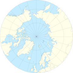
English: Location Map of the Arctic Ocean
|
| Datum | |
| Bron | Eigen werk |
| Auteur | Tentotwo |
| Andere versies |
|

Licentie
Ik, de auteursrechthebbende van dit werk, maak het hierbij onder de volgende licentie beschikbaar:
Dit bestand is gelicenseerd onder de Creative Commons-licentie Naamsvermelding-Gelijk delen 3.0 Unported
- De gebruiker mag:
- Delen – het werk kopiëren, verspreiden en doorgeven
- Remixen – afgeleide werken maken
- Onder de volgende voorwaarden:
- naamsvermelding – U moet op een gepaste manier aan naamsvermelding doen, een link naar de licentie geven, en aangeven of er wijzigingen in het werk zijn aangebracht. U mag dit op elke redelijke manier doen, maar niet zodanig dat de indruk wordt gewekt dat de licentiegever instemt met uw werk of uw gebruik van zijn werk.
- Gelijk delen – Als u het werk heeft geremixt, veranderd, of erop heeft voortgebouwd, moet u het gewijzigde materiaal verspreiden onder dezelfde licentie als het oorspronkelijke werk, of een daarmee compatibele licentie.
Shell script for generating the map using GMT archief kopie op de Wayback Machine
#!/bin/sh

# Set common options
PROJECTION=E0.0/90.0/20.0c
REGION=-180/180/50/90
FILENAME=arctic_ocean.ps

# Get Natural Earth datafiles
echo "Downloading datafiles from naturalearthdata.com"
wget -nv -nc \
 http://www.naturalearthdata.com/http//www.naturalearthdata.com/download/50m/physical/50m-coastline.zip\
 http://www.naturalearthdata.com/http//www.naturalearthdata.com/download/50m/physical/50m-land.zip\
 http://www.naturalearthdata.com/http//www.naturalearthdata.com/download/50m/cultural/50m-admin-0-boundary-lines.zip
echo "...done\n"

echo "Inflating archives"
unzip 50m\*.zip
echo "...done\n"

echo "Converting shapefiles to GMT"
ogr2ogr -F GMT 50m_land.gmt 50m_land.shp
ogr2ogr -F GMT 50m_coastline.gmt 50m_coastline.shp
ogr2ogr -F GMT 50m_borders.gmt ne_50m_admin_0_boundary_lines_land.shp
echo "...done\n"

echo "Creating maps"
GMT psxy -m -J$PROJECTION -R$REGION -Bg15 --POLAR_CAP=none --BASEMAP_TYPE=plain --BASEMAP_AXES=WeS 50m_land.gmt -K -G254/254/233 > $FILENAME
GMT psxy -m -J$PROJECTION -R$REGION 50m_coastline.gmt -O -K -W9/120/171  >> $FILENAME
GMT psxy -m -J$PROJECTION -R$REGION 50m_borders.gmt -O -W100/100/100  >> $FILENAME
echo "...done\n"

echo "You can now open $FILENAME in Inkscape to clean up the file and save it as SVG. You should add an ocean coloured background and simplify the graticules using CTRL+L."
Bestandsgeschiedenis
Klik op een datum/tijd om het bestand te zien zoals het destijds was.
| Datum/tijd | Miniatuur | Afmetingen | Gebruiker | Opmerking | |
|---|---|---|---|---|---|
| huidige versie | 27 jan 2012 13:54 | | 709 × 708 (589 kB) | Tentotwo |
Bestandsgebruik
Dit bestand wordt op de volgende pagina gebruikt:
Globaal bestandsgebruik
De volgende andere wiki's gebruiken dit bestand:
- Gebruikt op af.wikipedia.org
- Gebruikt op ar.wikipedia.org
- Gebruikt op ast.wikipedia.org
- Polu Norte
- Islla de la Soledá
- Adventfjorden
- Isfjorden
- Estrechu de Davis
- Aeropuertu de Jan Mayen
- Aeropuertu de Svalbard
- Módulu:Mapa de llocalización/datos/Árticu/usu
- Módulu:Mapa de llocalización/datos/Árticu
- Kvitøya
- Kükenthaløya
- Nordaustlandet
- Wilhelmøya
- Austfonna
- Storøya
- Estrechu d'Hinlopen
- Ny-Friesland
- Sorgfjorden
- Verlegenhuken
- Wahlbergøya
- Advent City
- Pyramiden
- Hiorthhamn
- Isfjord Radio
- Gebruikt op az.wikipedia.org
- Gebruikt op ban.wikipedia.org
- Gebruikt op bcl.wikipedia.org
- Gebruikt op ceb.wikipedia.org
- Gebruikt op ce.wikipedia.org
- Gebruikt op cs.wikipedia.org
- Gebruikt op de.wikipedia.org
Globaal gebruik van dit bestand bekijken.