Bestand:Bermuda NLT Landsat7.png

Grootte van deze voorvertoning: 800 × 580 pixels. Andere resoluties: 320 × 232 pixels | 640 × 464 pixels | 1.056 × 765 pixels.
Oorspronkelijk bestand (1.056 × 765 pixels, bestandsgrootte: 989 kB, MIME-type: image/png)
Dit is een bestand van Wikimedia Commons. Onderstaande beschrijving komt van de beschrijving van het bestand daar.
Commons is een vrij-gelicenceerde database voor afbeeldingen, geluid, video en andere bestanden. |
| Deze afbeelding bevindt zich in het publiek domein omdat het een screenshot is van NASA’s software World Wind die gebruik maakt van een publiek domein-laag, zoals Blue Marble, MODIS, Landsat, SRTM, USGS of GLOBE.
|
 |
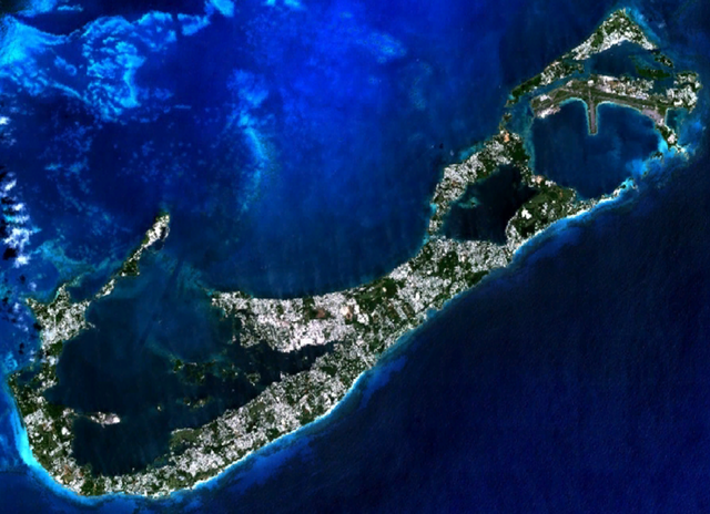
Visible colour satellite image of Bermuda.
Screenshot from NASA World Wind, NLT Landsat7 layer. Coordinates:
worldwind://goto/world=Earth&lat=32.31510&lon=-64.76256&alt=25664&tilt=1.0
Bestandsgeschiedenis
Klik op een datum/tijd om het bestand te zien zoals het destijds was.
| Datum/tijd | Miniatuur | Afmetingen | Gebruiker | Opmerking | |
|---|---|---|---|---|---|
| huidige versie | 16 apr 2006 22:58 | | 1.056 × 765 (989 kB) | Hautala | {{PD-WorldWind}} Visible colour satellite image of Bermuda. Screenshot from NASA World Wind, NLT Landsat7 layer. Coordinates: worldwind://goto/world=Earth&lat=32.31510&lon=-64.76256&alt=25664&tilt=1.0 |
Bestandsgebruik
Dit bestand wordt op de volgende pagina gebruikt:
Globaal bestandsgebruik
De volgende andere wiki's gebruiken dit bestand: