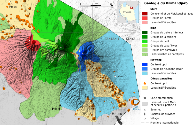
Bestand:Mount Kilimanjaro Geology map-fr.svg

Afmetingen van deze voorvertoning van het type PNG van dit SVG-bestand: 800 × 516 pixels Andere resoluties: 320 × 206 pixels | 640 × 413 pixels | 1.024 × 660 pixels | 1.280 × 825 pixels | 2.560 × 1.650 pixels | 2.670 × 1.721 pixels.
Oorspronkelijk bestand (SVG-bestand, nominaal 2.670 × 1.721 pixels, bestandsgrootte: 1,03 MB)
Bestandsgeschiedenis
Klik op een datum/tijd om het bestand te zien zoals het destijds was.
| Datum/tijd | Miniatuur | Afmetingen | Gebruiker | Opmerking | |
|---|---|---|---|---|---|
| huidige versie | 30 apr 2009 21:37 |  | 2.670 × 1.721 (1,03 MB) | Sémhur | Misspelling |
| 30 apr 2009 20:49 |  | 2.670 × 1.721 (1,03 MB) | Sémhur | == Description == {{Information |Description= {{en|1=Simplified geological map of the three volcanic centres of Mount Kilimanjaro (modified after Downie et al., 1965), Tanzania.}} {{fr|1=Carte géologique simplifiée du [[:fr:Kil |
Bestandsgebruik
Geen enkele pagina gebruikt dit bestand.
Globaal bestandsgebruik
De volgende andere wiki's gebruiken dit bestand:
- Gebruikt op bg.wikipedia.org
- Gebruikt op fr.wikipedia.org
- Gebruikt op oc.wikipedia.org
- Gebruikt op uk.wikipedia.org


